Secondary landslides hamper rescue efforts


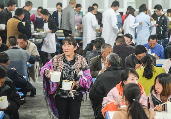 |
| Villagers affected by the landslide wait for supper at a center for displaced residents on Tuesday night. The center, located in an elementary school, provides accommodations and counseling services. [Photo by Hao Fei/China Daily] |
Teams temporarily leave site after new movement of rocks and mud
Rescue workers were forced off the massive landslide in Xinmo village, Sichuan province, on Tuesday morning by secondary slides.
At 11:04 am, about 200 to 300 cubic meters of rocks and mud in the debris field shifted. No casualties were reported, according to the relief headquarters.
On Monday at about 11:10 am, an alarm indicating the possibility of a new slide went off, and the entire rescue force had to evacuate. They resumed work about 1:30 pm.
Most of the rescue workers left the village by about 5:30 pm, as additional rain posed new safety risks.
A large drone with laser radar superior to traditional technology had collected data indicating the danger of a landslide on Monday, according to a rescue team from the Sichuan provincial administration of work safety.
"The site of the slide has lush trees, and we cannot see the actual terrain under the trees using traditional remote sensing image technology," said Liu Jiting, a member of the team. "But laser radar can get past the trees automatically to provide accurate data about the terrain."
At around 11 am on Tuesday, another landslide occurred near Daguan township school in Maoxian, more than 20 kilometers from Xinmo. Thanks to the early warnings, residents nearby were relocated in time, the relief headquarters said.
A total of 18 million cubic meters of rocks, mud and water slid from the top of Fugui Mountain and buried 62 homes in Xinmo early on Saturday, killing at least 10 residents and leaving at least 73 missing.
Sichuan is frequently hit by geological disasters as the overwhelming majority of the southwestern province is mountainous.
The Wenchuan earthquake in 2008 loosened up the underground geological structures in Sichuan, according to experts, and the Ministry of Land and Resources has stressed the prevention of geological hazards in the quake zone ever since, said Tian Tingshan, executive deputy director of the ministry's Geological Disaster Emergency Center.
The magnitude 8.0 quake that killed more than 69,000 people is blamed for many landslides in Sichuan. It rattled the deep rock mass of mountains in the province, creating a recipe for later disasters, researchers said.
The most severe landslide after the quake occurred in Sanxi village on July 10, 2013, burying eight rural resorts, killing 43 people and leaving another 118 missing.
Most of the dead and missing were tourists escaping the summer heat.


- Chinese scientist elected chair of UN commission
- Mideast tensions could increase costs for China's agricultural sector, expert says
- 7.5-magnitude earthquake strikes off Japan, no impact on China coast
- China opens citrus labs with Brazil and Montenegro in Chongqing
- Centuries-old Dong singing festival celebrates ethnic traditions in Hunan
- Chinese scientists discover new diatom species in Shanghai