China launches satellite to aid in early extreme weather detection


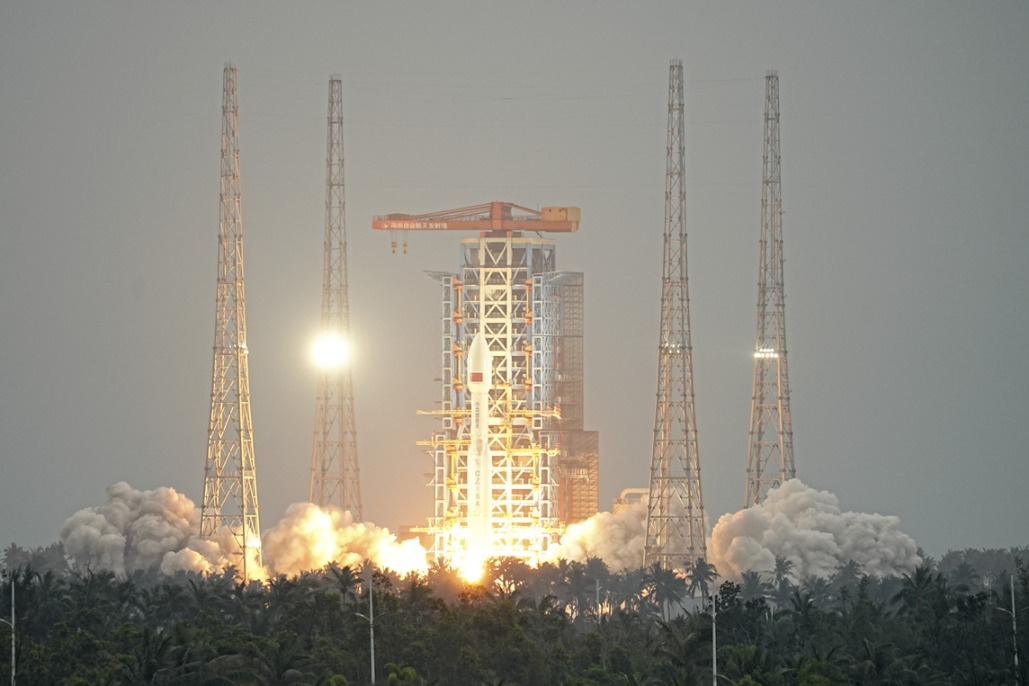
China launched a new geostationary meteorological satellite on Saturday, aiming to boost the country's ability to monitor extreme weather events and high-impact climate systems with greater precision, according to China Meteorological Administration.
The Fengyun 4C satellite lifted off at 12:07 am from the Xichang Satellite Launch Center in Sichuan province aboard a Long March 3B carrier rocket.
As the latest member of China's second-generation Fengyun 4 series, the new satellite will replace the aging Fengyun 4A and will operate in a network with the Fengyun 4B satellite.
Cao Xiaozhong, deputy head of the administration and chief commander of the Fengyun meteorological satellite project, said the launch will greatly strengthen meteorological early warning systems and improve responses to extreme weather.
"The Fengyun 4C represents a comprehensive leap in observational performance," Cao said. It offers high stability observation, high-precision remote sensing products, and high-efficiency data processing, he added.
The satellite is equipped with six payloads that meet advanced international standards and are designed specifically to capture small- and medium-scale weather systems that are often responsible for sudden and severe storms.
The geostationary radiation imager can complete a scan of China and its surrounding areas every five minutes and perform continuous rapid imaging of specific regions in one-minute intervals, allowing meteorologists to track the rapid evolution of storm systems in near real-time.
The interferometric vertical atmospheric sounder has improved its spatial resolution from 12 kilometers to 8 kilometers. It can perform routine observations every hour and intensified observations every 15 minutes, providing critical data for numerical weather prediction and typhoon forecasting.
The satellite also enables uninterrupted and full-domain lightning monitoring to support severe convection warnings, CMA said.
In addition to earth science, the Fengyun 4C carries advanced instruments for monitoring space weather and is capable of providing early warning data for space weather disturbances such as solar proton events.
The satellite is expected to be positioned at 133 degrees east longitude, extending China's monitoring range into the central Pacific Ocean.
Lu Feng, chief designer of the Fengyun 4 series satellites' optical ground system, said, once operational, the new satellite will strengthen monitoring of typhoon genesis regions in the Western Pacific, serving as the first line of defense for meteorological disaster prevention.
So far, China has launched 23 Fengyun meteorological satellites, with 10 currently in orbit. According to CMA, the network provides data services to 133 countries and regions and serves as a key engine for MAZU, an AI-powered meteorological system China launched this year to provide early warnings for all users.


- China launches satellite to aid in early extreme weather detection
- Report on mining accident that killed 6 suggests accountability for 42 individuals
- Law aimed at bolstering standard Chinese language education passed
- Connecting cities, changing lives
- World's longest expressway tunnel opens to traffic
- Taiwan lawmakers vote to pass motion to impeach Lai